The Boys Choice
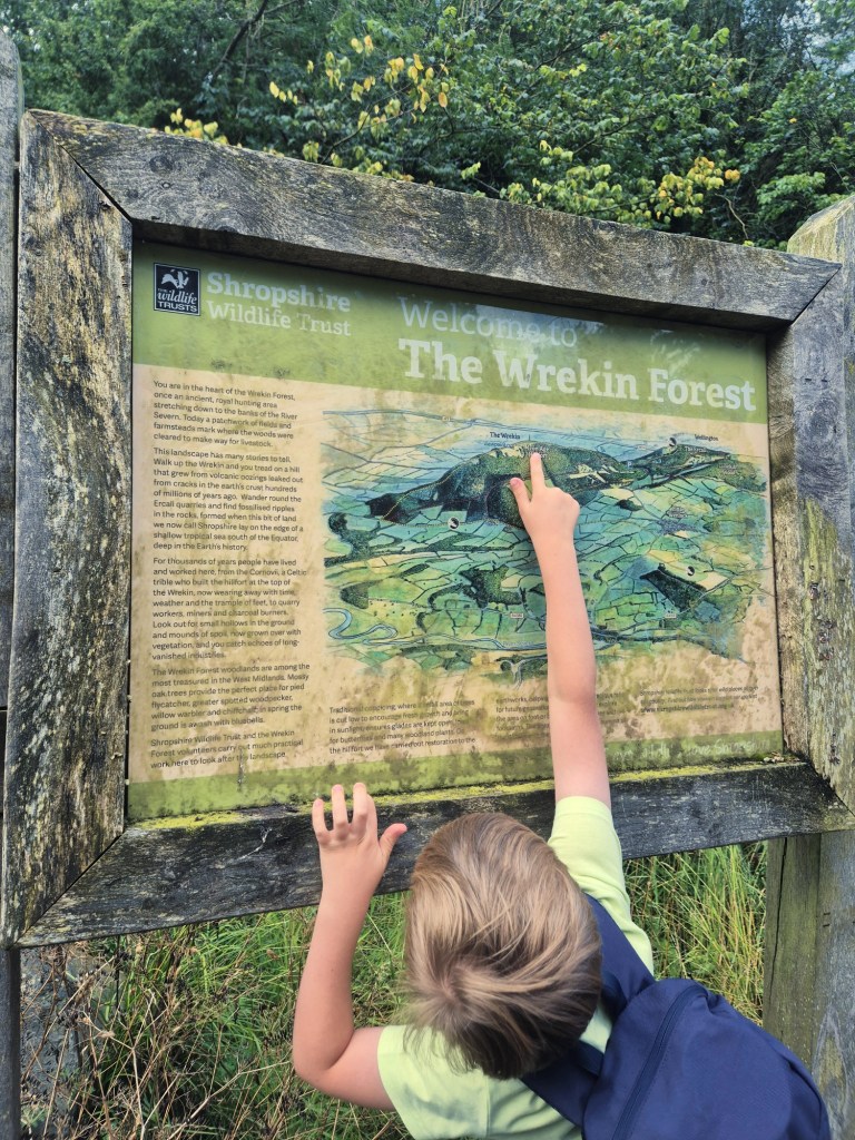
Today it was the boys choice for where we walked! We let them take control of the All Trails app, and they unanimously voted for The Wrekin! This has been on our “to walk” list for almost 6 years! We can see The Wrekin from our house, and almost everytime we look out of our bedroom window we utter We really must go there for a walk, and like I said in a previous post, we are finally putting our wishlist into action! Yay!
It took around 45 minutes to get to the carpark from our house, where we parked up and got our bags together. There is a charge, and I’ve included more details at the bottom of the post about the parking if you’re thinking of coming here. The start of the walk is almost immediately opposite the carpark…
Straight to the Climb!
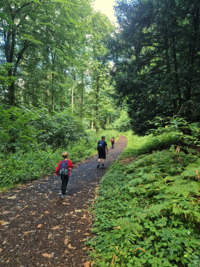
The climb starts immediately! There is no easing into it, or meandering a snake like path at a gentle gradient. Oh no, it’s straight in for the kill! We all had a good laugh about this despite the extra effort we needed for this walk. 🤣 We hadn’t researched the walk before going (we figured it was family friendly as we know a few families who’ve walked it) but for some reason I had it in mind that it would be a gradual ascent.

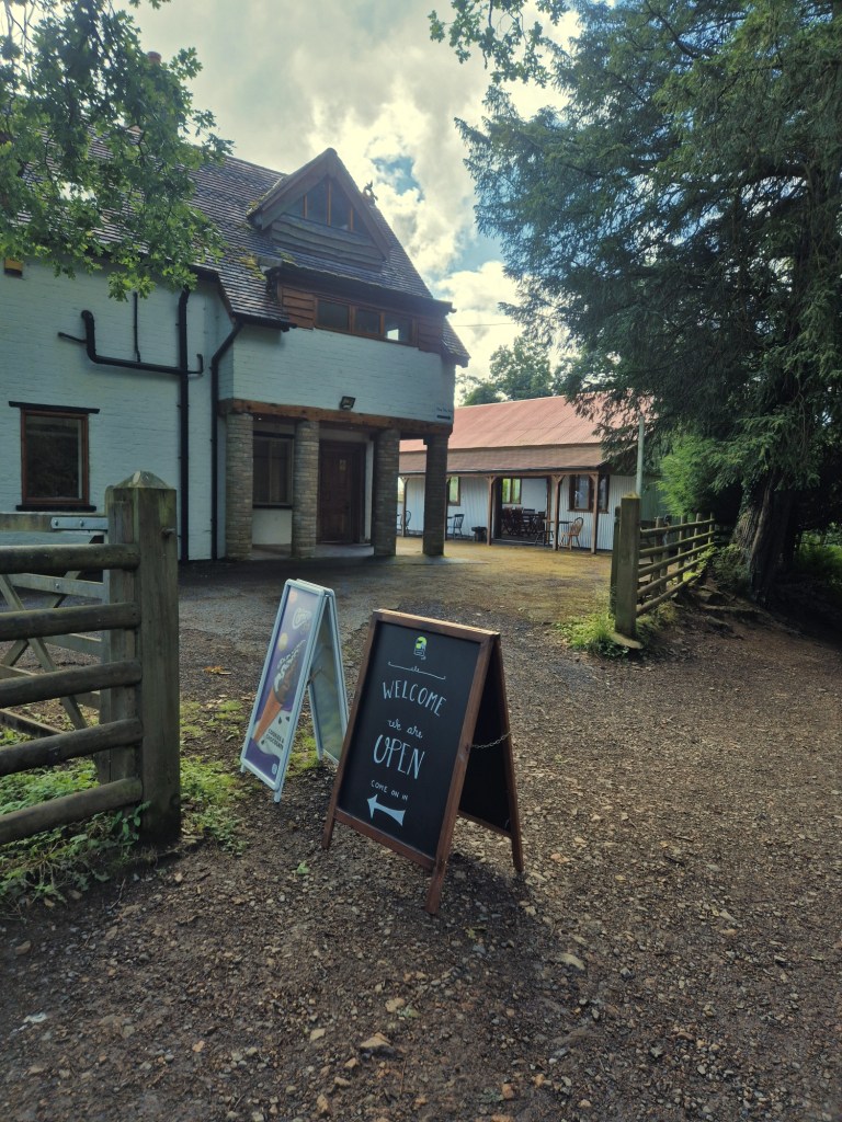
Halfway up, we came across ‘The Halfway House’, which served light refreshments, drinks, and most importantly, in this warmth, ice lollies! As we’d only just started our walk, we didn’t stop to eat, but I did take advantage of a (very smelly) portaloo – wild wees just aren’t so easy for us girls 🤣!
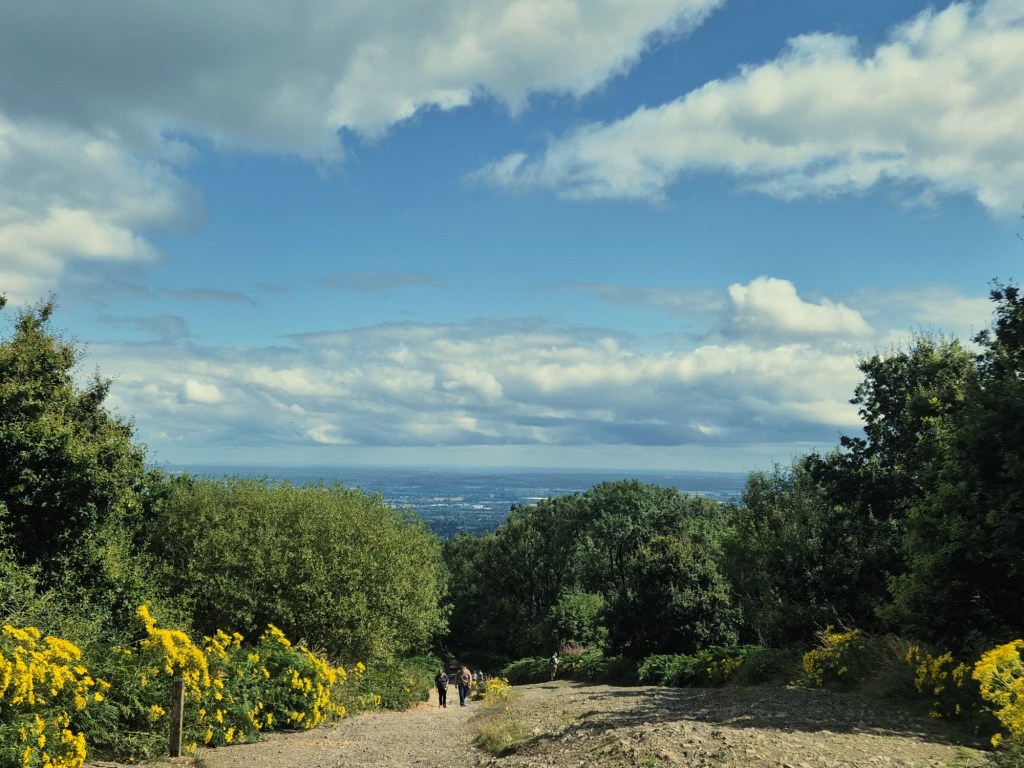
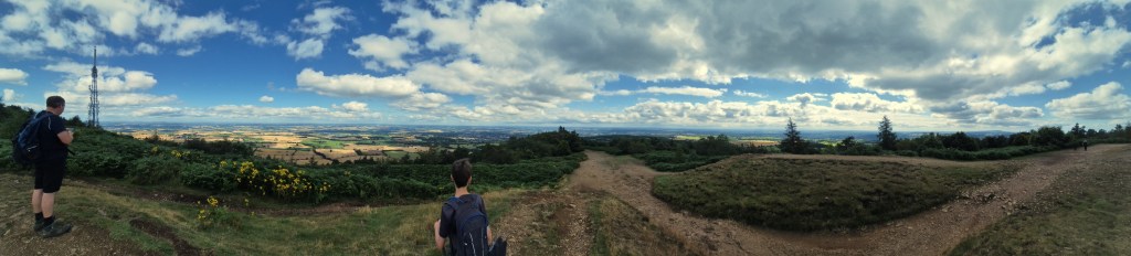
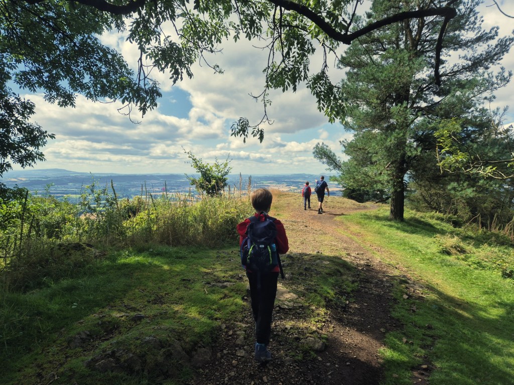
We then ventured up the next half of the walk. I’m pretty sure it was getting steeper with each step, but every time we turned around, we were met with the most beautiful, far-reaching views. We honestly couldn’t have picked a better day. It was so clear, we could see for miles!

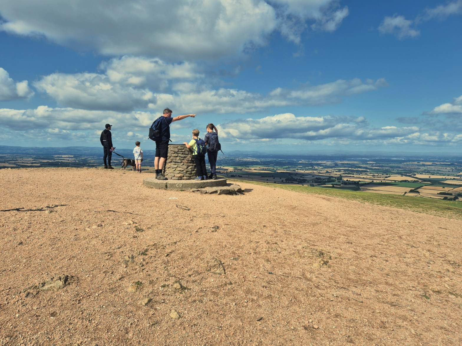
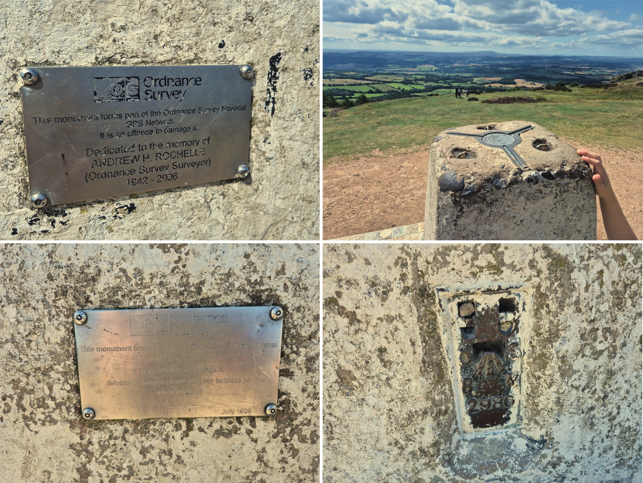
We Made It!
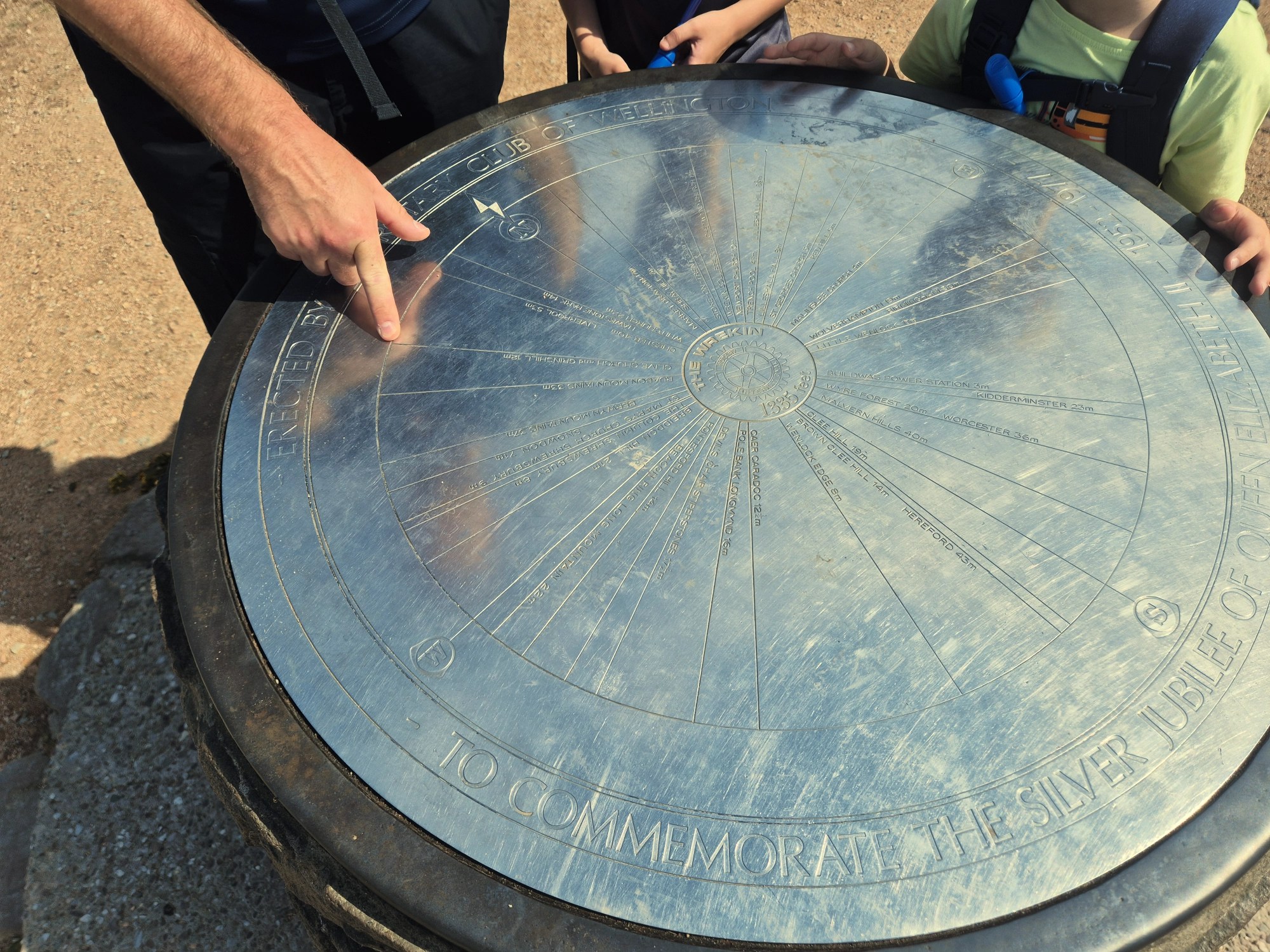
As we reached the top of The Wrekin, I was excited to see both a toposcope AND a trig point! I want to get into trig logging at some point, and I got really excited telling the boys all about them.

A lovely gentleman also offered to take our family photo at the trig point. We don’t get many with us all in, so I was really thankful for this!
Some Facts About The Wrekin
- The summit sits at 1334 feet above sea level
- It is NOT a mountain
- Over 100,000 people visit The Wrekin every year! 🫨
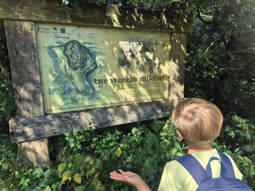
- The Wrekin is actually made up of 5 hills: The Wrekin, The Ercall, Little Hill (or Primrose Hill), Maddocks Hill and St. Lawrence’s Hill
- You can see 20 counties from the top of The Wrekin (on a clear day!)
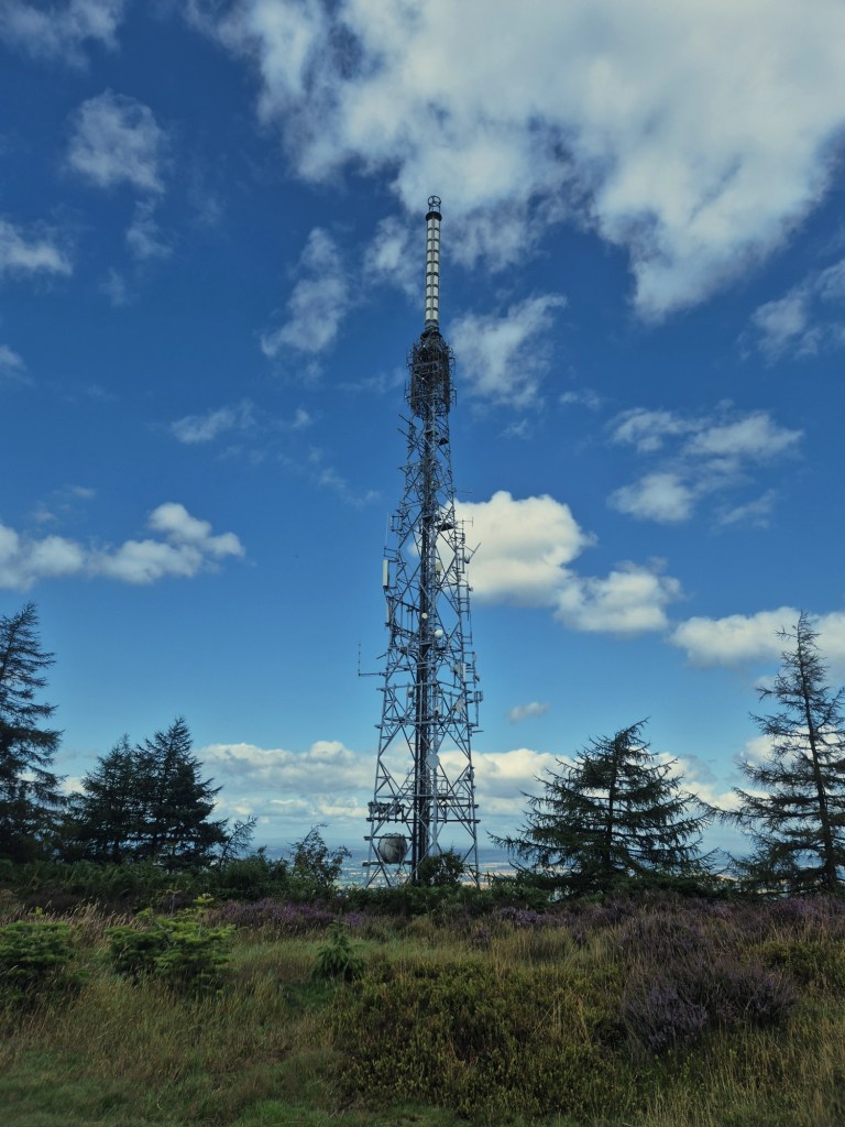
- The transmitter was erected in 1975
- There is a trig point at the top
Find out even more on the official website here!
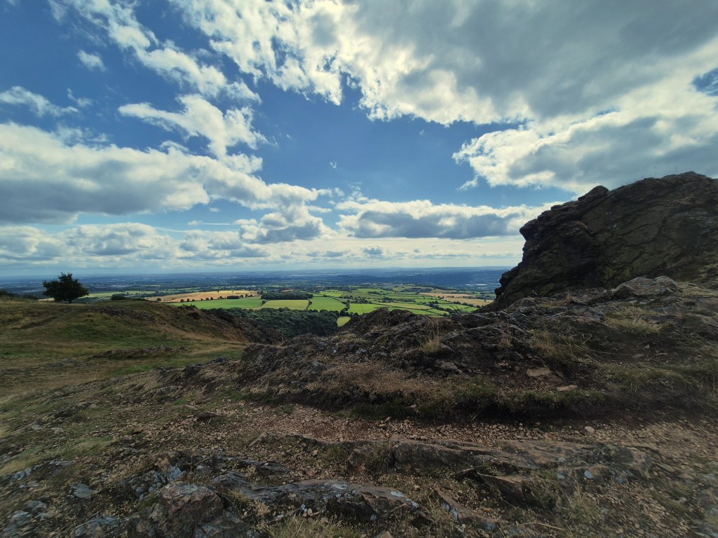
Just along from the trig point and toposcope was an interesting rock formation and more beautiful views. We decided this would be a lovely spot to enjoy a light snack and drink before heading onward. Unlike everyone else, who appeared to go back down the way they’d come, we went down the opposite way, and it was a lovely, quiet route, with not another person in sight!
Heading Back Down The Wrekin
The first part of our route back down was flat, but it soon turned down a very steep slope. It was much steeper than the route we’d taken to go up, and pretty treacherous too with lots of loose shale. We were glad we hadn’t walked up this way as we bet it’d have been incredibly tiring!
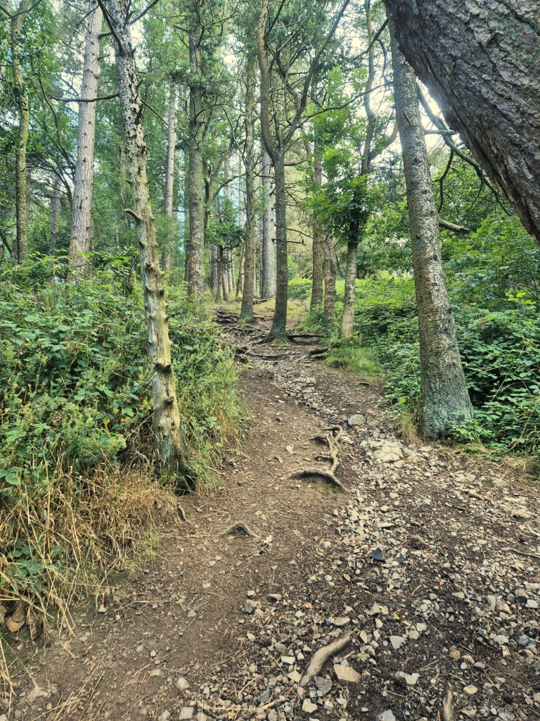
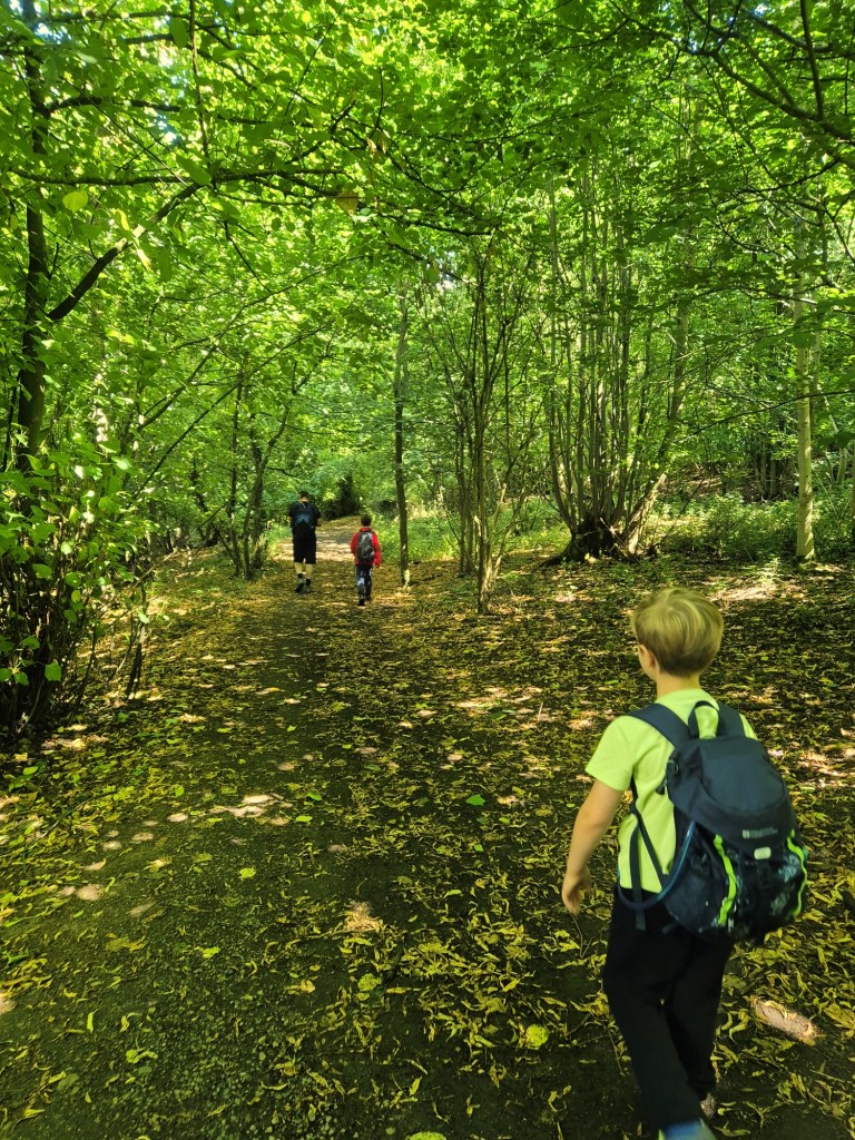
At the bottom of the slope, we were met with a lovely woodland walk, much like those we’ve just done at Bishops Wood and Swynnerton Old Park. I hadn’t expected to be walking through more woodland today, so it was a really lovely surprise!
We saw a cyclist and noticed lots of mountain bike looking routes with jumps. It’d be nice to come back here with our bikes when we finally get a suitable mode of transport!
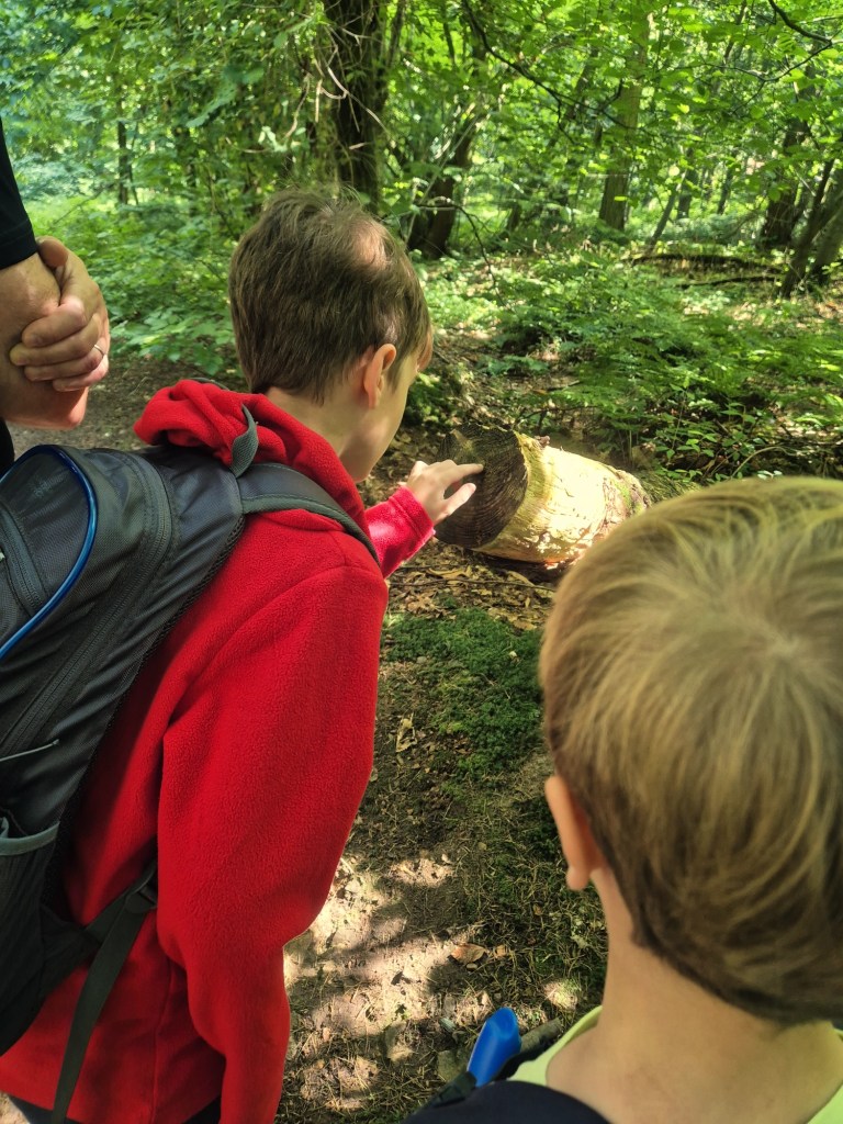
We spotted some cut down trees, and I told the boys about how you can tell a trees age by counting the rings. They were actually really fascinated by this, and we ended up stopping at every freshly cut down tree to work out it’s age!
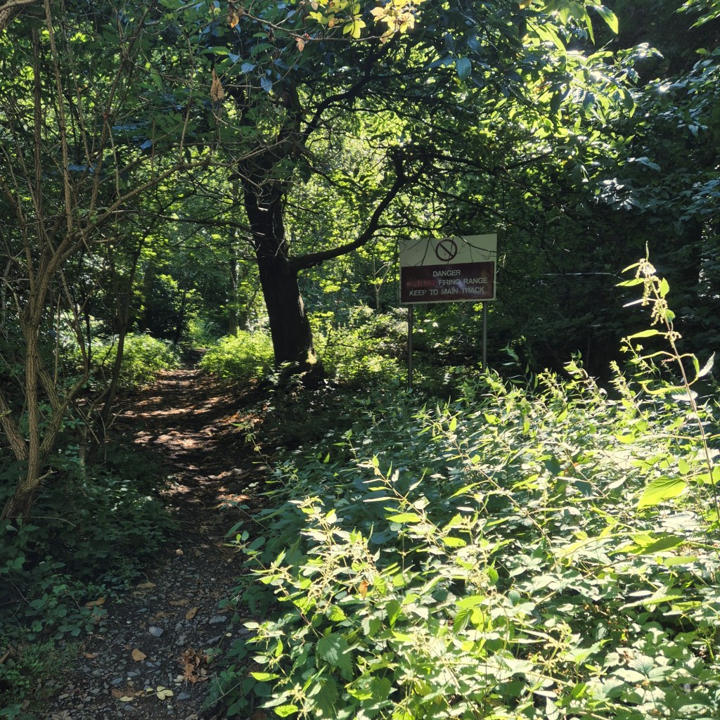
We spotted the above sign on our walk back, though it didn’t relate to the pathway we were on. Reading up on this now we’re home, it seems that this range is no longer used. In fact, the 1980s were the last time this range was actually used by the Kings Shropshire Light Infantry! You can read more about this here.
Family Feedback: The Wrekin
This has been the most ‘technically’ challenging walk we’ve done so far, as far as terrain goes, but the boys have just taken it in their stride, and I was really proud of them! My 10 Year Old says his favourite part was the steep walk down the other side of The Wrekin, and my 8 Year Old says his favourite part was seeing the views from the very top.
If you just walk to the summit and back down the way you came, it isn’t a massively long walk, and with the Halfway House serving refreshments, I think it’s a walk any family could do and enjoy. Sure, the steepness would be challenging, but you’re not on a route march, take your time, stop and admire the views every few minutes, and before you know it, you’ll be at the top! There are lovely photo opportunities along the way, and I think it would be something everyone would remember!
My thoughts: This was another walk I really enjoyed (that we all enjoyed to be fair) and that we’d all happily walk again. I’ve challenged everyone to do this again in a years time to see how much fitter we all are after a year of (hopefully many) family hikes 😄. We would also like to walk the other side of The Wrekin too, or maybe just go all the way around the walk at the bottom! Either way, I’m so glad we’ve finally ticked The Wrekin off our list!
Don’t forget to bring your water bottle and some (bribery) snacks to keep everyone motivated!
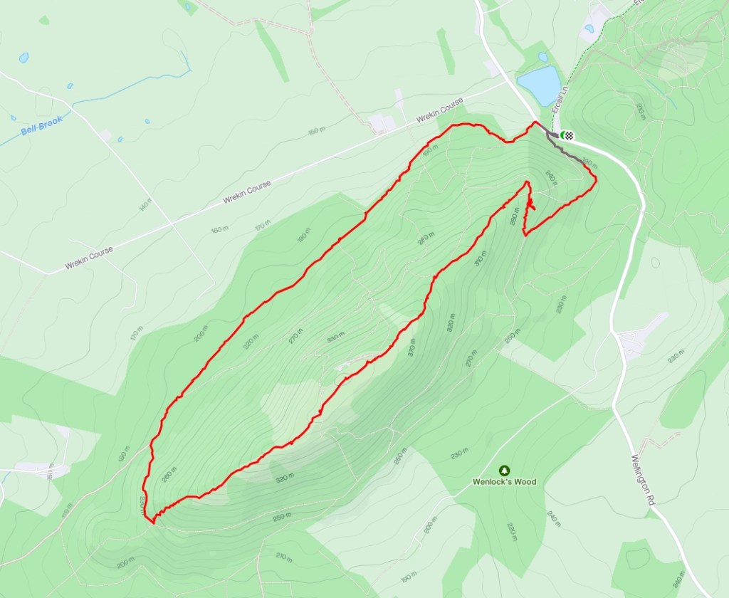
TOTAL MILES: 4.16 | TOTAL TIME: 2h30 (1h53 Moving Time)
Good to Know
Parking
We noticed as we drove up that there were laybys you could park in, that are probably free if you can find a space, but there is also a carpark. There is a charge, and the machine didn’t take coins, or at least the one I used didn’t. You can pay with a card or online by following the details on the sign as you enter the carpark. It’s operated by hozah.com, with charges as follows [up to 1 hour £1], [up to 2 hours £2], [up to 3 hours £3], [up to 12 hours £12]. ANPR was in operation, with cars photographed upon arrival and payment expected within 20 minutes of arrival. Our overall time here was 2h33, and we walked ‘the long way back’ – but as we weren’t sure how long we’d be, we went for the £4 option.
Discover more from Treks, Trails & Travel
Subscribe to get the latest posts sent to your email.

The Wrekin is a regular sight on many of my Shropshire walks but I only climbed it for the first time a few years back. The view from the top on a clear day is staggering and I could pick out lots of landmarks and hills. We walked down the same steep slope you did but I think we walked back on the other side. “Going round the Wrekin” is a common phrase in my homeland (the Black Country!) meaning to take a long way round rather than a direct route. 😀
LikeLiked by 1 person
That is a brilliant phrase, I love learning local phrases, might use it myself 😀 Next time we go we will try that other route you took. That slope was crazy! Are you still in the Black Country?
LikeLike
Looks like a great walk with gorgeous view ☺️.
LikeLiked by 1 person
It was brilliant, we all had a really great day and couldn’t have asked for a clearer view 😍
LikeLiked by 1 person
Yes it is an amazing viewpoint – I went in November 2022. I remember it had poured with rain all morning but in the afternoon when I did my walk the sun had come out and it was superbly clear.
LikeLiked by 1 person
How lucky were you with the weather! I think good weather really makes this walk, when you get the reward of the views at the top, it’s just amazing how far you can see! 🙂
LikeLiked by 1 person