
Since starting walking together this summer, we’ve had a lot of fun finding some great walks on apps like All Trails, and through local websites, but my husband thought it would be a fun idea to make our own circular walk up, so we dug out the OS maps and starting drawing…
Planning the Route
The boys always take a lot of interest when we drag the maps out, so after helping Dad create a 9 mile walk to Cheswardine and back, our 10-year-old decided he wanted to plan and execute his very own walk, guiding us down bridleways, across fields, along country lanes, and even beside a canal. Here’s how he did it and why it was such a rewarding experience for all of us.
The Journey Begins
Saturday 28th September 2024. The weather was starting to turn and the temperature was much cooler than our walk last weekend. We wrapped up warm and our eldest proudly hung the map pocket from his neck and lead us out of the house and onto his first walk as leader!
This walk was straight from our house and the first section was through footpaths and bridleways we use regularly when walking our dog, so the map didn’t come out again until around mile 2, after passing a golf course.
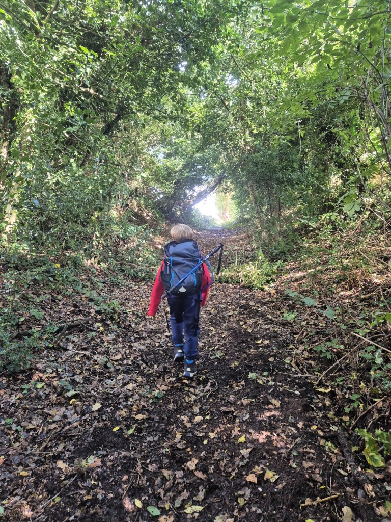
At this point, we watched him as he used the map to work out where we were, find our spot, then work out where we needed to go next. I was pretty proud throughout the entire walk of his ability to always know where we were and where we needed to go next. Spoiler alert – he didn’t get us lost once!

Navigating the Bridleways and Fields

After crossing the road from the bridleway into the field, the big grey cloud that had loomed over us threateningly decided to release some unforecasted rain, so we quickly threw on our waterproofs and bag covers before continuing. Fortunately the rain was short lived, and by the time we’d passed through the gate to the next field, it was dry again. Since there were no more very dark clouds around, we removed our wet weather gear again before continuing.
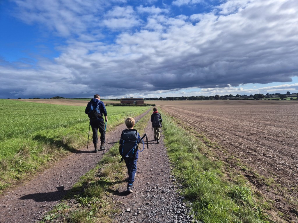
Our eldest continued leading the way confidently through several more fields, and finally onto a lane that we’ve never walked before. This lane lead us past some fancy houses with big gates and long driveways, and onto a restricted byway that joins onto another one of our local “dog walks”.

Having not walked it from this direction yet, I was pleased to see how quickly the boys got their bearings and realised where we were. There’s a really beautiful barn conversion along this track and it always sparks conversations from the boys about what they love most about the house.
Of course, we had to remember that we weren’t on the usual dog walk, so not long after passing through the fields behind the barn conversion, it was time for our eldest to consult the map again. This was now unchartered territory for us all…
Country Lanes, more Fields, and the Canal
It was around the midway point of the walk here, so we decided it was a good time to have a break. We tend to take breaks as and when the children ask for them, and it was here our youngest said he needed one. To be fair, with a cold looming, I was about ready to ask for one myself haha! We enjoyed a light snack and a good drink, took in the far reaching views (yes, we could see The Wrekin again!), then got back up again, heading through a pathway the farmer had left in the maize.
In this field, where we’d ordinarily turn left and go uphill for the dog walk, our eldest lad’s route saw us turning right and to the bottom of the field. At the gate post were clear waymarkers back where we’d come, but nothing directing us to where we were actually heading. The issue here was that it was difficult to see on the OS map which side of the hedge the public right of way was on. With one side thick in maize right up to the hedge, and the other freshly ploughed, our eldest took charge and suggested the open, ploughed, field – I’d have definitely chosen the same! As it turned out, he made the right choice, as right at the end of the field was the clear exit and another country lane for us to continue onward.
Once on the country lane, our eldest lad consulted the map again, and using some local landmarks was able to indicate where we were and which way down the lane we needed to go. Although we’ve regularly talked about maps and keys and looked at our routes on our OS maps when we’ve got home after walks, thanks to apps, we’ve rarely actually used one as our sole navigation aid on our walks to date. Despite this, it was amazing to see how much had sunk in from our home “map reading sessions”, and we could see just how much he had learned about navigation – it made me incredibly proud to witness his confidence grow with every step. He was no longer looking to his Dad for approval in his decisions, as he was earlier in the walk, but now taking the lead like a true little navigator!

Eventually we hit another road we needed to cross and continued onto a section of the walk that, unbeknownst to our 10 year old when he plotted it, his Dad and I had actually walked once before (when they were at school) after we had first moved to the area. It wasn’t a suitable walk for them back then, at 2 and 4, due to fragile stiles, boggy ground and a dodgy descent to the canal, so we’d never gone back. Several years later, taller and stronger, it was a more suitable route to take the children along too.
The footpath leads through what feels like someone’s back garden. Last time we’d walked it, it went between some houses and lead through a small field before heading out to a bigger, boggy field. Today the small field has been converted into a sweet little paddock, with chickens and a small number of sheep. It was really pretty! I took a photo of the interestingly horned sheep in there, but it has turned out disappointingly blurry so I shan’t share it – sorry about that!
At the other side of the paddock was the dodgy stile we’d used several years – now truly wrecked – so we climbed over the wobbly gate beside it (the vegetation was too thick to allow us to open it), and landed in the lovely big, but rather boggy, field. Bizarrely, the right of way leads down the right edge of the field, but then as you approach the bottom corner, it actually cuts across at a 45 degree angle. My eldest was on it, and had spotted that his route cut across instead of going to the corner and then walking along the bottom. It made us all wonder what might have been there or caused this strange diversion to avoid the corner from many years ago!
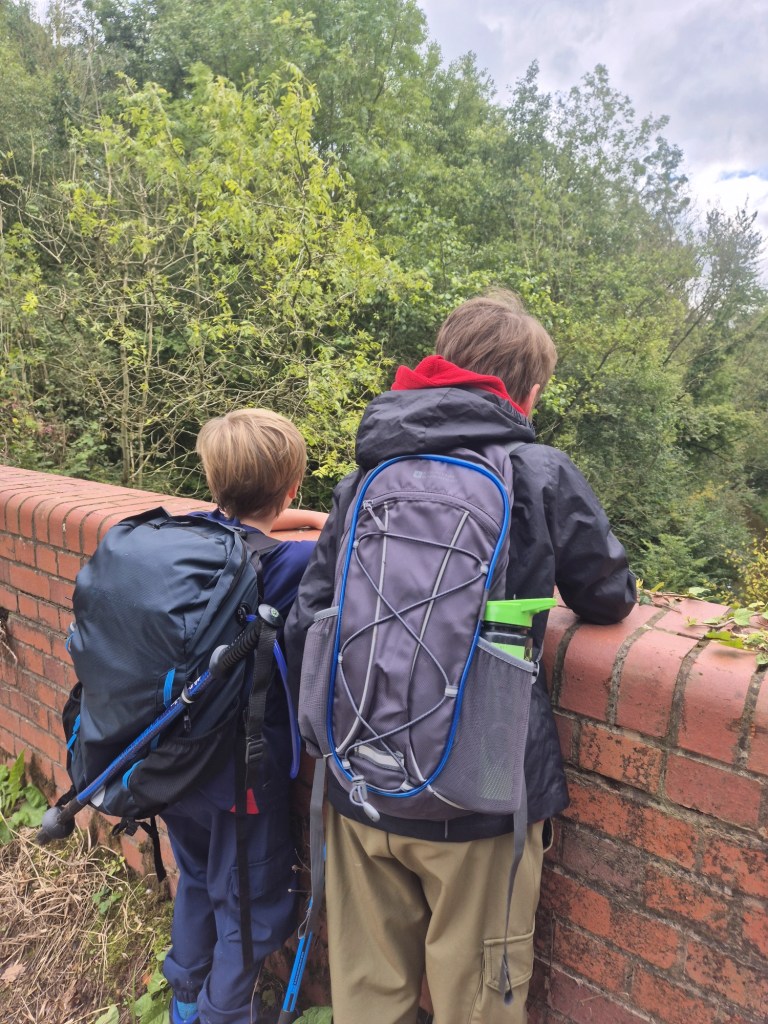
At the bottom of the field the grassy area narrowed and finished with a fence and a stile. Over the stile we found ourselves in a little wooded area, with a quaint stream and little wooden bridge, and the sound of a narrow boat engine in the near distance. We weren’t far from the canal now – yay! My memories of this walk were hazy, and I recalled an area where we had some issues with working out where we were supposed to go, and it didn’t help that it seemed like we were completely at a dead end, surrounded by hedges and thick trees. Fortunately, my husband spotted a way marker, but it appeared to lead into a bush. Clearly the route isn’t walked much. We are aware of local disputes with a local right of way and a farmer trying to block access and make things difficult. Consulting our map, this foot path is on his land, so I suspect it’s part of the area he’s trying to restrict.
We were keen to not have to walk all the way back home. It would either involve the shorter and less pleasant option of walking up an unpaved main road with fast traffic, or completely retracing our steps and adding several more miles onto our already long walk. Armed with our trekking poles and after getting back into our waterproofs to protect our skin and clothing, we dived into the thick bramble filled hedgerow and fought our way through. It was as dense as the awful experience we had at Bishop’s Wood, but fortunately, unlike Bishop’s Wood, it was short lived 😅. We soon emerged the other side, removed the thorns in our clothes, put our waterproofs back into our bags, and followed the right of way along the bottom of the field.

One memory that wasn’t so hazy of this walk from when my husband and I did it, was that access to the canal, where it should’ve been, was not there. It had been blocked. Being new to the area at the time, we were unaware of the local walking issues which I’m lead to believe have gone on for several years now! I’m guessing it was another access point that the farmer was trying to block to prevent access to the public rights of way. Fortunately it looks like the access has been reinstated – sort of. Certainly from the canal towpath anyway. A fairly fresh set of steps and a gate have been put in place, which I believe was done by the Canals and River Trust. Getting to it though, from the field, was a bit tricky. We knew there were steps here, having walked past them on the towpath, but there was no clear access point. My husband spotted a gap in the hedge that looked suspiciously like someone had beaten some nettles out of the way to get in or out, so he went ahead to see where it went… Shortly after we heard him shout up to say it was the right way! We pushed through the nettles and had a steep, slippy, climb down a muddy bank, followed by a very short wander through some trees, and there were the (extremely slippery) wooden steps and gates to the towpath! We were not beaten!
Finally, we had reached the highlight of the walk – a beautiful stretch of the Shropshire Union Canal! Here, we had a moment to relax and enjoy the scenery, take a family selfie, drink some more water, and watch as a narrow boat passed by.

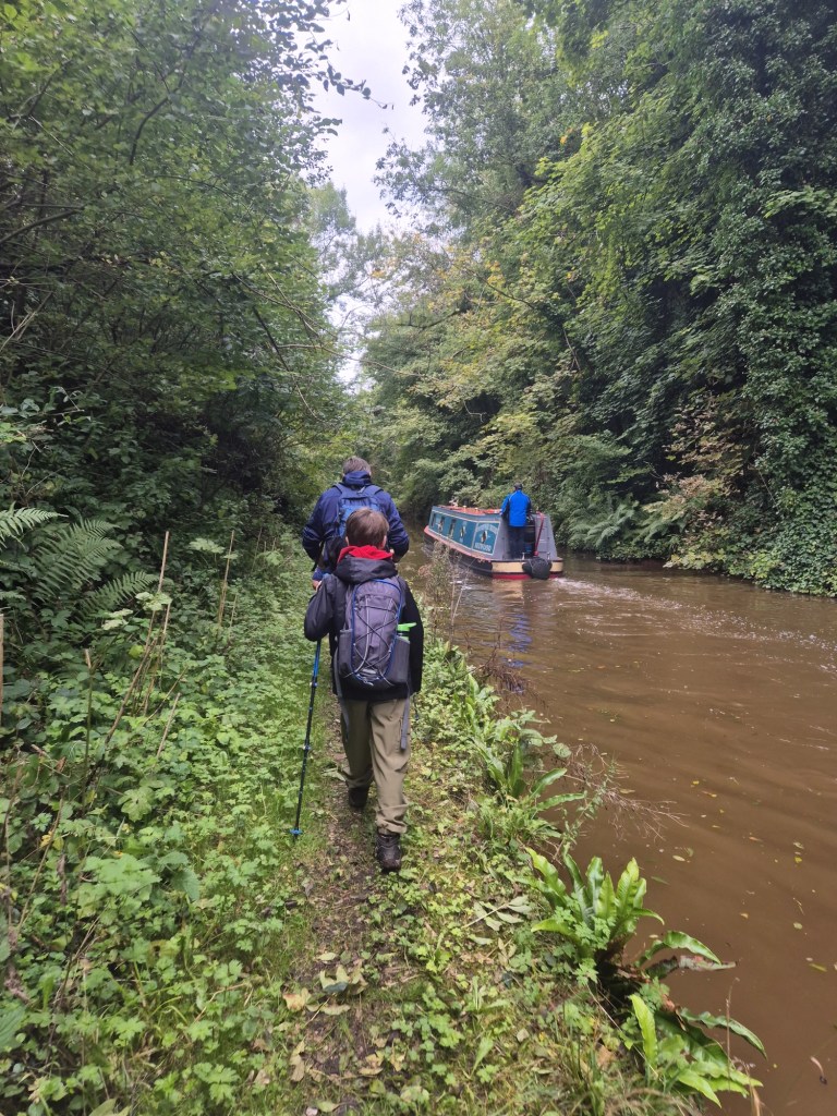
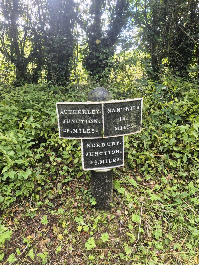
It is a bit of a treat to walk this side of the canal, as the stretch between Tyrley Locks and the Wharf is nearly always impassable due to land slips on the towpath, so we’ve all but given up trying to walk up it now. The towpath is narrow, very wet and slippery at times, but we take our time in single file wandering back towards Tyrley Locks. Our son’s face lit up with pride as he realised he had successfully guided us to the finish line. We hit the road from the canal to walk the final mile to our home.

What We Learned from Our Mini-Explorer
Our son’s achievement in planning and leading this 7.77-mile walk was not just about map-reading skills; it was a lesson in problem-solving, confidence-building, and the joy of exploring the great outdoors. He learned how to use his gut instincts when met with unexpected challenges (the hedgerow dilemma!), and we learned to trust his instincts and let him take the lead. Sometimes I think I step in too early to take over – but I made sure I left him to it today! It was particularly heart warming to see his younger brother looking up to him and taking onboard his comments and guidance with the map and where we needed to go next – at the moment they’re going through a stage where they prefer to disagree with each other!
It was a brilliant experience for all of us, and it’s safe to say that this won’t be the last time he leads us on an adventure. He was really proud of “his walk” and talked about it animatedly later that day, after a surprise visit from his Grandparents. He said he enjoyed the entire walk, and rather sweetly, so did his younger brother. We can’t wait to see where his OS map takes us next!
Tips for Encouraging Your Child to Take the Lead on a Walk
- Start with Shorter Routes: Begin with shorter, more manageable walks to build their confidence and skills.
- Teach Map Reading Basics: Spend time showing them how to read an OS map and understand the different symbols and features.
- Encourage Problem-Solving: Let them figure out how to navigate obstacles or make decisions about which way to go.
- Celebrate Their Successes: Praise their efforts and achievements, no matter how big or small.
This adventure reminded us that sometimes the best walks are the ones where you let your children take charge. They might just surprise you with what they can achieve!
TOTAL MILES: 7.77 | TOTAL TIME: 3h23 (2h49 Moving Time)
Discover more from Treks, Trails & Travel
Subscribe to get the latest posts sent to your email.

Fab effort at navigation, he’ll be on to his DofE before you know it
LikeLiked by 1 person
Ahh thanks on his behalf! I’m hoping he will 🙂
LikeLiked by 1 person
That is really good to teach them how to read a map. Very useful skill.
LikeLiked by 1 person
I thought the same! I hope it will help him in Scouts too 🙂
LikeLiked by 1 person
Well done young man! Don’t think I could read a map at that age!
LikeLiked by 1 person
This is how I got hooked on walking – local walks with my parents and then trips to the Peak district and Snowdonia. The same approach seems to have worked pretty well on my own kids who, now mostly grown up, remain keen to outdoor activities of various kinds.
Enjoy!
LikeLiked by 1 person
I love hearing things like this, thanks for sharing! It gives me hope that my boys will be like your children 🤞 being outdoors and active is so good. Thank you 😊
LikeLike